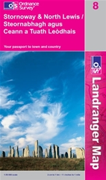
I’ve just compiled a list of OS Maps I’m going to need for the journey to Stornoway;
63 Firth of Clyde
69 Isle of Arran
68 South Kintyre & Campeltown
62 North Kintyre & Tarbet
55 Lochgilphead & Loch Awe
49 Oban & East Mull
47 Tobermory & East Mull
40 Mallaig & Glenfinnan
39 Rum, Eigg, Muck & Canna
33 Loch Alsh, Glenshiel & Loch Hourn
32 South Skye & Cuillin Hills
23 North Skye
22 Benbecula & Sout Uist
18 Sound of Harris, North Uist, Taransay & St Kilda
14 Tarbet & Loch Seaforth
08 Stornoway & North Lewis
The greyed out ones I’ve already got so that just leaves 9 OS Landranger maps. This is purely for detail of the coastline, I also need to tackle the Admiralty Charts to get my nautical info.
I think I’ll register online with OS and get printing exactly what I need, otherwise I’ll have no room in my kayak for food.
109 days till I leave Largs……..

